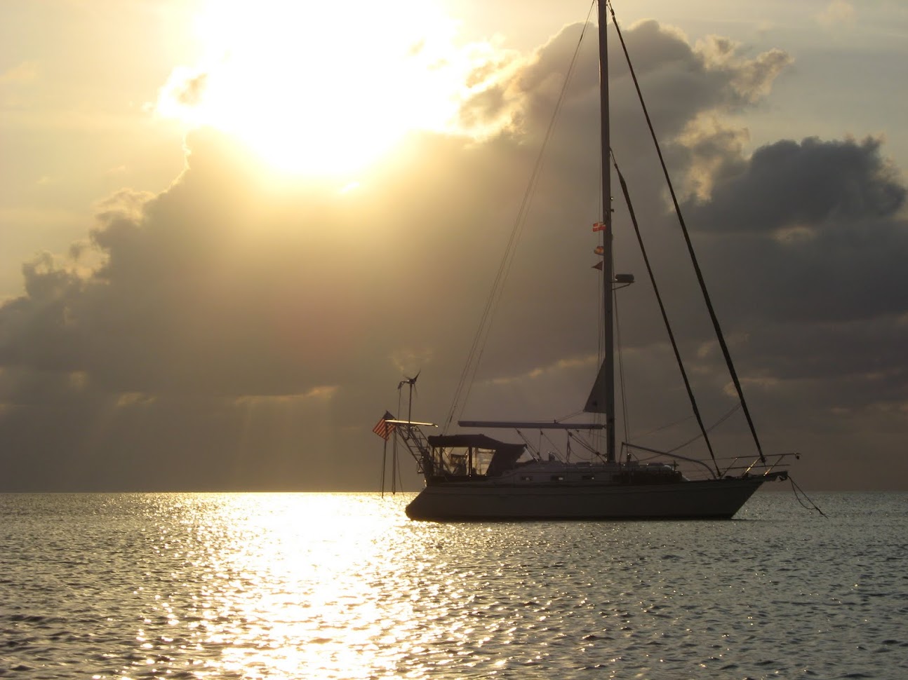
The cruising guide informs us that Georgetown Port Security wants to be called while the vessel is ten nautical miles from the port. At four PM, I called and said that I would not be anchoring at the port on the exposed west side of Grand Cayman because of the approaching cold front. I also did not want to use the alternative southern mooring field because the swells from the storm would affect that area as well. I informed them that I would prefer to round to the northern side of the island and anchor in the protected Governor's Harbor. They said I could do that and that I should call when we were anchored securely and that we must not go ashore until we were visited by the authorities. Roger that! Oh.....by the way..... we will probably not be able to clear the reef on the north until after dark. Could you give us waypoints to safely negotiate the reef and then to find the entrance to Governor's Harbor? Long pause. You have not been here before? No, sir. Long pause. He gives us five waypoints that I immediately plot on our chart plotter. As darkness falls, I fire up the RADAR and I check its alignment with the chart overlay and with what we can still observe visually. The waypoints I am given take us through the reef, but not in a buoyed area, but if you can't trust Port Security, who can you trust? The chart shows as little as six feet of depth in a couple of spots, but the seas were calm and we draw about 4.5 feet. So, with RADAR, SONAR and chart plotter holding my gaze and Barb with a spotlight on the bow we inched our way through the reef and into North Sound. It is a straight shot across the sound to the harbor entrance and through the mangrove lined channel into the anchorage. We dropped the anchor and backed down to the south in preparation for the weather to come. We reported our position (19 degrees 21.25' N and 081 degrees 22.62' W), thanked him for his help and fell asleep. At four in the morning the wind and rain began. We heard a sailboat calling Port Security from the port anchorage reporting that they were dragging toward the rocks ashore and the seas were very rough. They got themselves sorted out avoiding disaster and I was very glad that we were not in that location. The wind was strong, but Governor's Harbor was a snug little spot so there were no waves. The storm continued until dawn and stopped as suddenly as it had begun.
We called Port Security to inquire about when we could expect the authorities. They would be admitting two cruise ships in the south mooring field and they would probably not get to us until after noon. DO NOT go ashore. No problem. A little rest was welcome. We got a call at about 2PM that the officials were at the dock and I should dinghy in to the Governor's Harbor Yacht Club to meet them. The customs agent was there in her skirt and heels and the immigration officer was looking at me strangely. I soon figured that I was not going to transport them to our boat and that I should have had our boat documents and passports with me. I will go back to the boat and get those items and 'is it okay for my wife to come as well?' 'To be sure, I'm certain she wants to touch land. No problem.' All in proper Queen's English. All that got done and the weekend clearing fee was waived since it was their fault we had to wait for them. In fact, there were no fees at all. 'Welcome to Grand Cayman' and a discussion of transportation, provisioning and sightseeing left us with good information and a feel for the friendliness of the island.
We assembled our bikes and began our sightseeing. Hurricane Mitch had blasted the island years ago and the yacht club was no longer a yacht club. Half the docks were in place and they had no electricity at all and water only sometimes. It is now a major day trip, SCUBA diveboat and fishing charter embarkation point and diesel fuel was available from a stainless steel tanker truck. A half mile away was the main road that runs north and south the width of the eight mile wide island where most of the resorts and activity is found. Having the bikes was wonderful as public transportation is somewhat erratic and certainly expensive. Grand Cayman is reputed to be the most expensive island in the Caribbean. It is very civilized and it was embarrassingly comforting to be back amongst English speaking, first world people. Now, as we pedalled around, laundry on our backs and in baskets, I felt like the poor-visiting-the-privileged instead of the other way around like we had experienced for the last two years.

The beaches are beautiful, but the snorkeling is only mediocre. The diving is supposed to be great, but we did not do that. We dinghyed out to Stingray City where Barb enjoyed petting the huge stingrays in waist deep water. We biked to the turtle farm,
to downtown Georgetown,

to see where we would have anchored (see the surf better by clicking on the photos to enlarge them)


to the southern mooring field (Spotts),


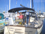
Early on, we met a British couple, James Stewart and Lucy Kennedy aboard Snow Leopard. They had the use of a car and we toured the eastern end of the island with them. On March 1st, we heard Kaija's Song on the radio, a vessel that we had heard before, but never met. They reported that they had lost their engine and then that they lost a shroud and were coming into the harbor under sail alone. We returned their call and assured them that they would have no trouble sailing into the harbor where we were and that we would dinghy out to tug them in should they need it. They negotiated the reef and the channel and anchored without a problem. We let Gary and Kaija recover from their stress and then spent the next three days with them as they arranged for repairs and did some sightseeing with us. Meanwhile, the wind continued out of the west and the northwest, the direction we planned to sail so we waited until Thursday, March 4th to check out of the country. The entire paperwork check in/check out in Grand Cayman cost $3 and with our check out documents we could purchase our diesel fuel without paying duty on it. The next morning we bid farewell to Grand Cayman, transitted the reef and sailed toward Isla Mujeres reporting our sea conditions and float plan to Port Security and to the Northwest Cruisers Net. We had light wind and very favorable current as we approached Isla Mujeres and dropped the anchor in their harbor in the late afternoon of the third day at sea. The next morning on the VHF the cruisers net reported that after the next few days it would be favorable for a passage north to the US so Barb and I decided we would not clear into Mexico and continue our journey after resting at anchor. We heard radio traffic from our friends from two years ago, Gary and Nicole on Chateau so we called them to say hello. They were leaving the next morning for Fort Meyers, FL. Have a safe journey! In a few minutes were are hailed by Patrick on Stolen Child. On May 5th, 2008, we had left the US from the Dry Tortugas to head for Mexico and arrived with Stolen Child. We enjoyed Patrick and Nancy's company in Isla Mujeres. Our paths crossed again in Roatan a year later. Here we both were in Isla Mujeres again and they were planning to return to the US at Key West at the same time as we were! What symmetry! So we got together aboard Jupiter's Smile and discussed our strategy for navigating the Yucatan Current and the Gulf Stream together.
On the 9th of March, we pulled out of the harbor together and began executing our plan. We were hailed by Michael on Sea Biscuit who reported that they were leaving as well and we agreed to set up a radio watch schedule to track each other and report conditions for the duration of the trip. We had met Michael and Robin in Roatan as well and attended Robin's birthday party there the year before. Michael served as a radio net controller for the Northwest Caribbean Net and had a very good radio signal. The journey started well, but late in the day the wind increased beyond the forecast twenty knots and we found ourselves in twelve foot seas on the beam through the night. We were making good progress until the next day when seas came down, but we lost the favorable current. We spread out to try to find it again. Sea Biscuit was closest to the Cuban coast and we were farthest north. Sea Biscuit reported that they had found the current again so we headed southeast to pick it up ourselves. That is one advantage to traveling with company and staying in touch. That evening, at our scheduled 10PM SSB radio check, I heard a very faint voice calling us. It was Nicole on Chateau, the boat that had left a day before us.
The signal was weak and Nicole has a thick French Canadian accent so it was difficult to determine the nature of her distress at first, but we were able to learn that Gary had taken the dinghy to land on the north coast of Cuba to give their black lab, Alpha, a potty break earlier that evening, before dark. Nicole had heard gunshots and Gary was still not back at the boat. She was frantic. We discussed plans to help and determined that Sea Biscuit, farthest from Nicole's position, but with the strongest radio would continue on, but head toward the Dry Tortugas and call for assistance along the way even though they were unable to hear Nicole. Stolen Child would turn toward Nicole's position since they were closest to her and maintain radio contact with her. We would remain in place to relay messages between Stolen Child and Sea Biscuit. Michael began his appeals for help on all the emergency frequencies, but got no answer from anyone. Patrick was doing a great job of reassuring Nicole, but was still seventy miles away. I said I would check back with Patrick every ten minutes, but that I was going to start scanning all frequencies and call for help as well. The only answer I got was from Sea Biscuit. Then, at 1:30 AM we heard Gary reporting that he was safe with Alpha on board Chateau. He had gotten lost in the mangroves, it got dark, he ran out of gas. He came upon a fishing camp and a fisherman and a guard towed him back to Chateau. The guard was along to make sure the fisherman did not leave Cuba with Gary and to check on the sailboat. Tragedy averted, we three boats resumed our journey towards Key West.
Patrick and I knew we would not make Key West before dark on the 11th so we sailed slowly through the rest of the night and day and let Stolen Child catch us (and in fact they passed us.) Sea Biscuit called us at our scheduled 2PM radio check and said that they would probably make Key West just after dark and would not call again unless something was amiss. At dawn, on the 12th, the wind had died and we were just outside the ship channel into Key West together, when a huge cruise ship approached from the east. Patrick hailed them, but they ignored him. Not knowing what the ship was intending to do, we both started our engines and diverted to avoid them. Once they cleared us, we motored up the channel and made note that the ship that ignored us was the Celebrity Century. A note to Celebrity Cruise Lines yielded no satisfaction making me question their attention to seamanship and safety. We activated our cell phone and called Homeland Security to check into the US and received a clearance number. We were advised that we needed to report to immigration in person with our passports within 24 hours. We saw Sea Biscuit anchored and we anchored nearby. We were home!