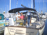
Nov 18 - Dec 26, 2014
On 18 November, Jupiter's Smile was moved out of secure storage in Marina Seca at San Carlos, Sonora, MX and into the work yard to prepare for splashing on 26 November. We reunited with our friends on Tisha Baby and Viva, made some new friends and had a very productive and enjoyable time in Marina San Carlos. We put our van in storage on 1 December. On 3 December at 0300, under mostly clear skies and well lit by an almost full moon, we departed Marina San Carlos to cross the Gulf of California to the Baja side. As we crossed and dawn broke, I discovered that an osprey had attempted a landing on our mast head and had bent a part of our windex and disabled it. The windex is a purely mechanical wind vane that is non essential, but it is a very nice device used to easily see the direction of the wind at a glance. Since this wind direction indicator is redundant to our electronic indicator it did not concern me and that I knew that I could fix it later. We anchored at Santispac in Bahia Concepcion, arriving at 1730, just before dark.
We stayed there at anchor for five days. Tisha Baby arrived in the anchorage and skipper Richard (a retired electrical engineer) and I (willing gofer and tool holder) went ashore to help repair a HAM radio. This radio belongs to HAM operator, Geary Ritchie, who voluntarily forecasts the weather for the western coast of Mexico. He had been off the air since hurricane Odele buggered his antenna in September. His daily transmissions were sorely missed. He posts his weather forecasts on the Internet as well, but in many places (like Baja California where we were) there is no Internet access and cruisers rely, in part, on his very excellent forecasting over SSB radio. I include the link below and encourage you to explore the rest of the site with a map, chart or atlas handy to better realize the range of his forecasts and the scope of his efforts.
Richard was able to determine that the antenna was indeed the problem and we repaired it. Geary was able to transmit the next morning from El Burro Cove and there was a collective round of applause (microphone clicks) for Richard's success. We spent time with Richard and Pam, on our boats and hiking ashore, made more new friends and travelled with two of them in their truck from their beach camping site to the town of Mulege for an Internet, grocery and lunch opportunity.
We departed Santispac on 9 December and made daily anchoring stops at San Juanico, Puerto Ballandra (anchoring off Loreto for lunch at Orlando's along the way), Agua Verde, Isla San Francisco, Ensenada de la Raza, Bahia Falsa and arrived at Marina Palmira in La Paz, 15 December. Barb did laundry and I climbed the mast to straighten the windex. After a week of pleasant marina time, taking "land showers," shopping and exploring in La Paz, we departed to anchor only a few miles away in Bahia Falsa once again. Over the next two days we covered just over 100 nautical miles anchoring in Ensenada de los Muertos and Bahia Los Frailes. We planned on staying at Los Frailles for a day, waiting for the forecast 30+ knot wind to abate some before we set out toward Banderas Bay and the Puerto Vallarta area some 280 nautical miles away across the mouth of the Gulf of California. We had had strong northerly winds reaching over 30 knots getting to Bahia Los Frailes, but they were well on our stern and we had had a pretty good ride in relative comfort. We did, however, lose the part of the windex I had bent back into place a few days before. I thought that it was holding on by a whisker and I was right. At least the part that points into the wind is still there and that will serve us just fine. We had been sailing just ahead of another sailboat, Vivacia, and while we went to anchor in Bahia Los Frailes, they went on, headed to Banderas Bay. We talked with them on the radio and again the next day and they reported a pretty boisterous sail through the night, but had made excellent progress toward their destination. We slept well at anchor. I need to add that they were on a time table to meet their daughter on the 27th so they were using the most dangerous piece of equipment on a boat, a calendar.
After speaking with Vivacia, we listened to Geary's forecast at 0745 on the Sonrisa Cruiser’s Net. The wind strength forecast had been down-graded a bit and while the waves were still at 2 meters, higher than we like, they were following seas and at about a 14 second interval. A small sailboat left during the net heading Southbound toward Cabo San Lucas (46 nm) or San Jose del Cabo (28 nm). The forecast was for the northerly wind to continue through the morning, but then it would drop off to almost nothing by mid-afternoon, then backing, blowing from the east and then south through the next day and beyond at less than 10 knots. The seas would persist running with a 2 meter swell. With little wind in the future and needing to run the motor with the swells, the boat would roll. That makes for an uncomfortable passage. I elected (and Barb conceded to my judgement call) to take off immediately to at least have one day of good sailing.
The small sailboat was now out of sight and the seas looked okay so I put out the main and then the head sail to the first reef point. We motored out of the anchorage past Cabo Los Frailes and from there the wind took us on our way blowing in the mid-20s from astern. We were sailing at about seven to eight knots, so that brought the apparent wind speed below 20 knots and the waves, even though they were higher than the day before (sometimes eight feet) we were running with them astern of our port side. Hand steering instead of using the autopilot, I would glance over my shoulder to scan the horizon from time to time to look for traffic. One time, I looked behind and saw nothing at all and realized I was seeing a wall of water just off our stern, but our little vessel just gently rose and accelerated to nine knots on the face of the wave and it passed us without incident. Had I not looked behind me or at the knot meter I would not have noticed anything remarkable. As a rule, in closer to shore, the winds are accelerated and veer parallel to the coast so they are always higher than forecast. As we got out away from shore, the wind that had been in the low 30 knot range from time to time, fell off some and so did the seas. We continued this way into the early afternoon. Barb had not been pleased with these conditions, and had not applied a Scopolamine patch, but she tolerated it and as the wind diminished, the seas were now more rhythmic and we were more and more comfortable as the time and miles went by, still making good time, into the late afternoon. By dusk the wind was down to the point where the motor was needed. I left the mainsail reefed but took in the head sail and ran out the staysail and successfully dampened the rolling motion in the swell.
Motoring through the night was uneventful with no traffic appearing on RADAR or AIS and the sea state had diminished to be hardly noticeable. It was still running a six foot swell from astern of us, but the wave period was probably sixteen-seconds and the sea surface was like glass. The entire next day was much the same and when the easterly breeze appeared it gave us a little help as I put all our sails out. Santa had brought us a very mellow Christmas at sea. By evening, the breeze appeared from the southeast, right on our nose so I pointed a little more to the south to keep our sails filled and the boat stable. This worked out just fine because now we would be skirting the Islas Marias along their Southwestern coast. These islands are a Mexican prison facility where it is required to be twenty miles off. We made good progress through the night with the islands at twenty nautical miles on our RADAR screen and as dawn broke we were able to skirt the southern most island and adjust our course only slightly to port now toward Punta de Mita and the mainland 50 nautical miles away. By 1300, 26 December, we were anchored at La Cruz de Huanacaxtle.