Tuesday, January 31, 2012

Alabaster Bay, Governor's Harbor, then Rock Sound

On the 24th of January, we arrived in Alabaster Bay and Gone With the Wind was anchored there.  Barb and I saw them eating a late lunch as we walked by on the beach at Cocodimama's Resort.  We were headed to Barb's favorite beach on the East side of Eleuthera to beach comb so we simply waved a hello and had a brief word.  After a good long walk and a long walk along the beach, we returned empty handed, but happy to be in paradise.

The pink sand beach on the "ocean side"


The next day we had nice (expensive) lunch at the resort.

Cocodimama's street side
Cocodimama's beach side and dining
I got a good WiFi connection in the lobby

I could see Jupiter's Smile at anchor

That evening we invited the crew of Gone With the Wind aboard for "sundowners" and had a good visit with this very nice couple, Liam and Annie.  As I mentioned in the blog piece about Harbor Island, they have sailed half way around the world from Sydney, Australia and they have interesting stories and a beautiful boat.

On the 26th, we moved on to Governor's Harbor and shortly after, Gone With the Wind anchored nearby. Barb and I went ashore to get some groceries and do some exploring.  That afternoon, Rogue Brit, a Hunter 466 came into the anchorage.  
(left to right) Rouge Brit, Gone With the Wind & Jupiter's Smile in Governor's Harbor with our ship's tender (dinghy) Big Red in the foreground, left


The wind had turned out of the Southeast now and that was the direction we wanted to sail so we decided to stay in Governor's Harbor for a few days, until the wind shifted.

We were encouraged by a shop owner and the librarian to go to the weekly Friday fish fry, a community fund raising event which begins at 5 PM.  Well, it really begins around 6:30 and the food is not ready until around 7, but that was all just fine as we talked and got acquainted while we waited.

Annie, Jay, Barb, Liam, Trevor & Christy
Give your order and it is written on the back of the styrofoam container along with your name
Then wait for your name to be called, pay $10 and enjoy


Barb and I both had fish, peas and rice and cole slaw.  Chicken and pork were also available as was macaroni and cheese and french fries.  It was a fun time and we returned to our boats around 9:30.  The event went on into the night and early morning.  The next day, I spoke with the librarian about the evening remarking that most of the patrons of the fish fry were tourists.  She replied, 'yes, until about 10 and then the locals begin to show up, after the tourists have left.'  Bahamian people are typically night people it seems.  The local youngsters had been practicing for their junkanoo competition (a combination marching band and costume event like Mardi Gras) the previous night and this night the adults were partying.

During the day children were sailing their boats

The next day, Barb and I hiked to the East side of the settlement and found the ocean beach and walked half its length to a blow hole.  Again, we found no treasures to bring back with us, but we enjoyed the walk over the hill.
A nice house on the hill overlooking the harbor

Liam and Annie invited the crew of  Rogue Brit, Trevor (the ex Brit) and Christy from Nevada, and us over to  Gone With the Wind for sundowners and we had a very nice visit with our new friends.  We returned to our boats after dark and Barb prepared a lobster tail for our dinner.  It is not nearly as good as Maine lobster, but it was still a treat.

On Sunday, Liam, Annie and I helped Trevor and Christy with a short list of boat improvements and trouble shooting on Rogue Brit.  We then all went to lunch at a nice restaurant overhanging the sound where Liam teased the good natured waitress, entertaining us all.

The wind was forecast to shift to the Northeast and strengthen considerably so Barb and I decided that we would leave early on Monday to take advantage of that and head to Rock Sound farther down the island, about 25 miles away.  I had spoken to Chris Parker, our Marine Weather Center guru and he suggested that the wind would increase as the day progressed and would provide a "screaming beam reach" in pretty calm seas down the lee side of the narrow island.  His prediction was pretty much correct and as we turned around the point to enter the Rock Sound harbor the wind was blowing about 22 knots.  Rogue Brit traveled along with us and Gone With the Wind left the anchorage two hours behind us.  They covered the distance in about half the time, arriving just after us, having measured a top speed of 17 knots at one point.  Gone With the Wind lives up to its name!

The sailboat Sea Biscuit is in the harbor.  We know them from our time in Roatan, Honduras, in 2009, and from our eventful return trip to the USA from Isla Mujeras, in 2010.  It will be good to begin February with a reunion with them.


Barb and I dinghyed in to shore and went the grocery store just north of the main part of the settlement to get some things that we couldn’t find in Governour’s Harbor and after a walk around, returned to the boat meeting the crew of New Attitude, Jack and Linda along the way.  The next day we went to shore in town to do laundry at a very nice, not so cheap laundromat, walked to the Ocean Hole Park (a blue hole where the fish expect to be fed) and paid for a few days of internet.  We scouted out Sammy’s Place as a meeting place for the cruisers on the nine boats in the harbor.  In 2006, Pat Wharry on S/V Shamrock organized a cruiser’s lunch at Sammy’s Place and some of those people have become long-time friends, so that event is a fond memory that we thought we might duplicate.  We had a successful day doing chores.

Tuesday, January 24, 2012

Northern Eleuthera, Bahamas

On January 14th, we sailed almost due East on a Northerly wind and a Southerly current to the cut between Egg Cay and Little Egg Cay and onto the banks at the northern end of Eleuthera.  With Barb at the helm we sailed brilliantly and took a mooring at Spanish Wells.  
Spanish Wells' 8 moorings.  Call "Bandit" on VHF16
The cost of the moorings has increased from $15 to $20 a night and we stayed three nights.  We walked around the charming settlement enjoying the opportunity to get propane, diesel fuel, lunch at Norma’s Takeout and groceries at the Food Fair.  This is an old, established settlement with a long tradition of fishing and the look of the place reminded us of New England. 


Quiet on the waterfront Sunday morning

I love the sight of the blue sea.  Parliament is elected every 5 years and people decorate their cars with their party's flags.
They decorate the graves of past (passed) voters all year round.


 Having spent our mooring budget, we moved off the mooring in the East wind to anchor behind Meeks Patch on the banks West of Spanish Wells and spent a quiet night alone at this anchorage.
On January 18th, we traveled about 15 miles East and South, through the reef, outside and around the Devil’s Backbone and back through the cut into Harbor Island anchoring just off Valentine’s Marina and Resort.


From the stern - S/C Gone With the Wind in view

Off the starboard quarter

Valentine's landside

Valentine's waterside with our dinghy and Barb on the dock


Harbor Island is probably the ritziest place in the Bahamas after New Providence Island where Nassau is located.  But it is ritzy in a low-key, get-away-from-it-all kind of way.  The Duke of Windsor had a “home” here as well as other famous folk and there are some very nice boutique hotels along the beach. 

White Lodge's land granted in 1791 by King George lll to a loyalist subject, John Teddor

White Lodge


I was impressed by the banyan tree


Lush landscaping


Narrow street carved through the limestone


The Government dock with the fast ferry, Bo Hingy ll in port


Golf carts are the preferred form of transportation


Two of the many "Straw Market" stands


A tasteful jewelry store


Another neat avenue


This is an old Loyalist Cottage, 1797 with a contemporary guest


 We spent two days walking around the settlement and the “pink sand” beach, enjoying lunches out and grocery shopping and doing laundry.  Many visitors come for the day, but that is not enough time to do the island justice.  We did that in 2007, so we knew better this time and enjoyed ourselves.  At one of the "take aways" we encountered a couple from the Australian sailing catamaran Gone With the Wind.  We came to find out that they bought their boat new in 2004, just as we did, but since that time they have sailed from Sydney westward, into the Mediterranean Sea, across the Atlantic, up and down our East Coast and now we meet here in Eleuthera.
Leaving Harbor Island, we were able to sail back the way we came, passing Spanish Wells and sailing to Royal Island Harbor where we stayed two nights.  Royal Island Harbor has good protection from all directions.  It is a private island, but the development’s progress has been stopped so we were able to roam at will, with no one to ask for permission to do so.
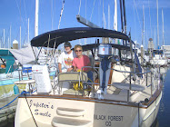
On January 23 we sailed to Current Cut and went through on an almost high tide, which caused us to be flushed through at nine knots, but into the wind, so there was quite a bit of choppy, shallow water to navigate.  We got through safely, going straight ahead through the “alternate route” instead of the route that we had used before that turns just past Current Island.  Once safely through we motored into the wind toward the “Glass Window”, a space cut by the sea that would effectively cut Eleuthera into two parts if it were not for a bridge.  We anchored nearby and dinghyed ashore for photos. 


View from the bridge - Jupiter's Smile at anchor in the distance.  Click on photo to enlarge.


 In 1997, the bridge was battered by a rogue wave and knocked seven feet to the West.  The government built a second support beneath the bridge and just repaved the road in its new position.


The Glass Window
The next day, we sailed to Hatchet Bay and entered the cut to look around at the moorings, but since it was early, we decided not to stay there and sailed on to Alabaster Bay.

Thursday, January 12, 2012

Leaving the USA


Our last, necessary piece of mail arrived on the 5th (thank you, John for all the mail forwarding!)  So, our next journey begins.  On January 6, 2012, just after dawn, we cast off our mooring in the Marathon City Marina, Marathon, Florida.  We took on thirty gallons of diesel fuel at the Marathon Marina, headed out to motor into the light headwind and then motor sail along Hawk Channel to Rodriguez Key along the Eastern Coast of Florida.  We anchored and while Barb prepared supper, I studied the charts and planned our route through the reef, into the Gulf Stream, to the cut at Gun Cay and the Bahama Bank.  The crossing might take over ten hours (you never really know until “you’re out there”) so I decided we would raise the anchor before dawn and navigate the reef in the dark trusting the chart kit from Maptech, the electronic C-Map chart from Jeppesen, instruments from RayMarine, the engine from Yanmar and our skills.  All went as planned and by sun-up we were in the Atlantic headed for the Gulf Stream.  Two things indicate the Gulf Stream: first, if you are headed in the right direction, you gain “speed over the ground” as indicated by the GPS. 


The wind blew almost directly at us, as we expected, but its speed dropped off, also expected, so we were motoring at about 6.2 knots, but our GPS read 9.5 knots.  We were in the Gulf Stream!


Once you reach deep water (thousands of feet deep), the water turns a clear, deep, indigo blue.  


We passed through the cut 


early enough (2:45 PM) to enable us to keep on going so that we could anchor on the Bahama Banks, in about ten feet of water, ten miles beyond Gun Cay.  


The waters were crystal clear and dead calm.
Yes, that is 10 feet of water!


Sunset in the Bahamas - We made it!


With only the slightest tiny waves, it made for some interesting visual effects.


The moon setting into its own reflection

We decided to forgo checking into the Bahamas at Bimini as we had done on two previous trips and to try a new destination, Great Harbor Cay, in the Berry Islands, about sixty miles farther on the banks.  Since it was Sunday, we decided to anchor nearby, again on the banks, and then near Cistern Cay the next night. We entered the marina on Tuesday morning to clear into the country. 
Clearing in was painless (as long as the departure of $300 USD for the privilege of cruising the Bahamas for as much as a year, with some restrictions, doesn’t hurt) with the Customs and Immigration Agent coming from the nearby airport to the marina to meet with us.
We stayed two nights and spent a lot of time exploring the island on foot.  


The marina basin
Manatee right off the stern of our boat


A place for people to swim as well
Twice, however, we were given rides.  The first, by Reverend Charles who gave us a mini-tour after trying to complete an errand and he gave us a recommendation for lunch.  
The Reverend Charles' church
 We took his recommendation the next day. 
Cooliemae's restaurant served us lunch - stemed fish, peas and rice and cole slaw.  T'was tastie!
Afterwards we were picked up by a British woman who gave us a ride to the end of the road that led to a beautiful beach.  Over the two days we completely covered the entire length of Half Moon Beach beach combing.  


Barb found some sea beans and some nice shells.

When we left the marina we sailed around the north end of the Cays and anchored along Half Moon Beach.  The next morning we motored the short distance into the cut between White Cay and Devil’s Cay and anchored behind Fowl Cay.  We explored White Cay’s beaches. As we returned to the boat, the dinghy engine displayed the same problem it had in the past.  The engine would run at high speed, but the boat would slow.  Since I suspected that the propellor hub was bad I had bought a used prop in Marathon.  I decided to go to land and change the prop, so we dinghyed to Hoffman Cay to view the inland blue hole we had visited five years before.


The prop change took five minutes and engine worked perfectly.


When we returned to the boat we saw two other vessels in the next anchorage and went to visit each for a moment.  We met Forest and Susan and their guests on the Island Packet 44 Rejoice and we have heard them since on the radio when we check in on the Cruiseheimers Net in the mornings.
The Cruiseheimers Net consists of cruisers that keep in contact with each other on the single side band frequency 5.152 MHz (USB) at 0830 each morning.  It began as a small group that found that, as they cruised, they would tend to forget where they were or what day it was and what season it was.  This affliction (or blessing - depending on your point of view) was labeled Cruiseheimers Disease.  Cruisers check in from Central America (Roatan this morning) to the Chesapeake and places in between and when you hear a familiar boat name check in, you can contact them and converse (on a different frequency) and catch up on the news between you.  It is both a social and a safety thing that provides comfort along your travels at sea and in foreign places.  Last week, a cruiser at Rum Cay had lost their dinghy during the night.  It had become untied from their boat and was just gone.  Through Cruiseheimers, the dinghy was identified and found, drifting in Exuma Sound, blown by the winds and carried by the current over 100 miles away.  The unlucky cruiser had his luck turned indeed, by a fellow cruiser who had  listened to the Cruiseheimers Net.