
Our last, necessary piece of mail arrived on the 5th (thank you, John for all the mail forwarding!) So, our next journey begins. On January 6, 2012, just after dawn, we cast off our mooring in the Marathon City Marina, Marathon, Florida. We took on thirty gallons of diesel fuel at the Marathon Marina, headed out to motor into the light headwind and then motor sail along Hawk Channel to Rodriguez Key along the Eastern Coast of Florida. We anchored and while Barb prepared supper, I studied the charts and planned our route through the reef, into the Gulf Stream, to the cut at Gun Cay and the Bahama Bank. The crossing might take over ten hours (you never really know until “you’re out there”) so I decided we would raise the anchor before dawn and navigate the reef in the dark trusting the chart kit from Maptech, the electronic C-Map chart from Jeppesen, instruments from RayMarine, the engine from Yanmar and our skills. All went as planned and by sun-up we were in the Atlantic headed for the Gulf Stream. Two things indicate the Gulf Stream: first, if you are headed in the right direction, you gain “speed over the ground” as indicated by the GPS.
The wind blew almost directly at us, as we expected, but its speed dropped off, also expected, so we were motoring at about 6.2 knots, but our GPS read 9.5 knots. We were in the Gulf Stream!
The wind blew almost directly at us, as we expected, but its speed dropped off, also expected, so we were motoring at about 6.2 knots, but our GPS read 9.5 knots. We were in the Gulf Stream!

Once you reach deep water (thousands of feet deep), the water turns a clear, deep, indigo blue.

We passed through the cut

early enough (2:45 PM) to enable us to keep on going so that we could anchor on the Bahama Banks, in about ten feet of water, ten miles beyond Gun Cay.
The waters were crystal clear and dead calm.
 |
| Yes, that is 10 feet of water! |
 |
| Sunset in the Bahamas - We made it! |
With only the slightest tiny waves, it made for some interesting visual effects.
 |
| The moon setting into its own reflection |
We decided to forgo checking into the Bahamas at Bimini as we had done on two previous trips and to try a new destination, Great Harbor Cay, in the Berry Islands, about sixty miles farther on the banks. Since it was Sunday, we decided to anchor nearby, again on the banks, and then near Cistern Cay the next night. We entered the marina on Tuesday morning to clear into the country.
Clearing in was painless (as long as the departure of $300 USD for the privilege of cruising the Bahamas for as much as a year, with some restrictions, doesn’t hurt) with the Customs and Immigration Agent coming from the nearby airport to the marina to meet with us.
We stayed two nights and spent a lot of time exploring the island on foot.
Twice, however, we were given rides. The first, by Reverend Charles who gave us a mini-tour after trying to complete an errand and he gave us a recommendation for lunch.
We took his recommendation the next day.
Afterwards we were picked up by a British woman who gave us a ride to the end of the road that led to a beautiful beach. Over the two days we completely covered the entire length of Half Moon Beach beach combing.

Barb found some sea beans and some nice shells.

 |
| The marina basin |
 |
| Manatee right off the stern of our boat |
 |
| A place for people to swim as well |
 |
| The Reverend Charles' church |
 |
| Cooliemae's restaurant served us lunch - stemed fish, peas and rice and cole slaw. T'was tastie! |

Barb found some sea beans and some nice shells.

When we left the marina we sailed around the north end of the Cays and anchored along Half Moon Beach. The next morning we motored the short distance into the cut between White Cay and Devil’s Cay and anchored behind Fowl Cay. We explored White Cay’s beaches. As we returned to the boat, the dinghy engine displayed the same problem it had in the past. The engine would run at high speed, but the boat would slow. Since I suspected that the propellor hub was bad I had bought a used prop in Marathon. I decided to go to land and change the prop, so we dinghyed to Hoffman Cay to view the inland blue hole we had visited five years before.

The prop change took five minutes and engine worked perfectly.

The prop change took five minutes and engine worked perfectly.
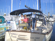
When we returned to the boat we saw two other vessels in the next anchorage and went to visit each for a moment. We met Forest and Susan and their guests on the Island Packet 44 Rejoice and we have heard them since on the radio when we check in on the Cruiseheimers Net in the mornings.
The Cruiseheimers Net consists of cruisers that keep in contact with each other on the single side band frequency 5.152 MHz (USB) at 0830 each morning. It began as a small group that found that, as they cruised, they would tend to forget where they were or what day it was and what season it was. This affliction (or blessing - depending on your point of view) was labeled Cruiseheimers Disease. Cruisers check in from Central America (Roatan this morning) to the Chesapeake and places in between and when you hear a familiar boat name check in, you can contact them and converse (on a different frequency) and catch up on the news between you. It is both a social and a safety thing that provides comfort along your travels at sea and in foreign places. Last week, a cruiser at Rum Cay had lost their dinghy during the night. It had become untied from their boat and was just gone. Through Cruiseheimers, the dinghy was identified and found, drifting in Exuma Sound, blown by the winds and carried by the current over 100 miles away. The unlucky cruiser had his luck turned indeed, by a fellow cruiser who had listened to the Cruiseheimers Net.


No comments:
Post a Comment