
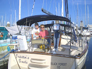
All the boats: Moira, Gone With the Wind, Rogue Brit, New Attitude, Mellow Moon, Savage Sun, Bobbyland and Sea Biscuit accepted my invitation and Sammy’s place was happy to accommodate the nineteen diners celebrating the first of February. Later that evening, crews from Rogue Brit and Gone With the Wind came aboard for sundowners and good byes to Gone With the Wind, bound the next day for the Exumas. This was a successful day doing social things.
It was good to see Michael and Robin from Sea Biscuit again. They had been on Roatan when we were there in the winter of 2008/2009 and we had attended Robin’s birthday party at a beautiful house on the top of a hill on the island. Yet another “small world” incident - Bob on Savage Sun is the uncle of one of my former students in Colorado Springs, Lisa, who is a good friend of another student, Jamie who is a foster sister to Christina whom we consider to be our God-daughter. Bob’s wife, Bev, e-mailed Lisa to tell her of this chance meeting and was informed that Jamie was having her baby at any moment. I got onto Facebook the next morning and learned that Quinn Patrick Walker was born to Craig and Jamie Walker on February 2nd. The internet connection was too slow to use for Skype, unfortunately and even e-mails that were sent were slow. I found that some never went through at all. That is internet in the Bahamas. It is slow, rationed and expensive, even for the residents on Eleuthera and Cat Islands.
On the morning of February 3rd, Rogue Brit departed toward Cat Island, which I considered a bold move considering what the weather forecast had been the previous day. I called Chris Parker for a recommendation for us for the 56 mile passage to Cat Island or for a stop along the way at Little San Salvador Island. He said that today would be the best for the next several days, if we could get underway immediately. In hindsight, he never said “good.” Possibly, he remembered some of our previous passages and what we had “survived” and figured - ‘What the heck. They can take it!’
We got the dinghy hoisted and the boat ready for sea in record time and hoisted the anchor. As we rounded the Sound Point leaving Rock Sound we saw a dot on the horizon that was Rogue Brit. Calling them on the radio informed us that the current out Davis Channel and the cut at Powell Point was mild and favorable. I elected to save some miles and use the narrower, Poison Channel to Powell Point. That worked brilliantly and as we rounded the point we were coasting (sailing close to the shore) to be sheltered from the seas, but still getting wind. A little farther along, we were disappointed that we had to be very close-hauled transiting southeast along the “tail” of Eleuthera Island. We could not keep our head sail from luffing without heading away from the shelter of the land so, with the mainsail and staysail only, we ran the engine to keep our speed up and used the energy to make more fresh water along the way. We knew that we would need the engine to turn toward Cat Island anyway, just not this soon. We rounded East End Point into big seas from the Atlantic. The seas were off our port bow and the wind was almost on our nose, but it was “only” about 25 miles to Cat Island so we passed Little San Salvador Island and pressed on. We had visited Little San Salvador Island before and I thought that while the anchorage could be a refuge, it would be a rolly one and Barb said keep going. Then she got sea sick. We still had 15 miles to go and as we got closer to Cat the seas moderated, thank goodness. By the time we were near our planned anchorage, the seas were down, Barb had recovered and we called to Rogue Brit to learn that they were anchored in about 13 feet of water just off the beach at Bennett’s Harbour. It was important to know the depth, because our depth sounder was acting strangely. Even though we had been close to shore along the “tail” of Eleuthera we were in nearly 1000 feet of water and at that depth the sounder does not register. As we “returned to land” off Little San Salvador Island we should have gotten a hit from the bottom at only 65 feet, but we didn’t. On the sounder, an image appeared, but it was fuzzy and it did not agree with the charted depths for our location. The charted depths were still safe, but this apparent instrument failure was a concern. And it was now sundown with three miles to go - another half hour. There were no obstructions to our path on the chart so we just kept coming and anchored behind Rogue Brit it what we assumed was deeper water and pulled back against the anchor to assure it was set and it held. We turned off instruments and running lights, turned on the anchor light and while Barb prepared our supper, I compared notes with Trevor assuring him that the kinds of conditions we had experienced are not, by any means, the norm and should be avoided in the future. Christy was glad to hear that and agreed about avoidance.
The next morning, I turned on the instruments and everything was working properly again. I accessed the sounder and checked wires and it still worked. So I decided to stop fixing it before I broke it. Trevor, Christy, Barb and I went to shore and spoke to a young Canadian fellow at his boat tied at the government dock. He had been there six weeks already and since he had lost his dinghy, he had to be at the dock. He and his crew were on a good will mission helping the Cat Islanders rebuild after hurricane Irene had smacked them last fall. He advised us how to get to the settlement and what there was to see. It is a very small settlement! We came upon the Halvorson House Villa Resort and Restaurant. Matt Halvorson came out to greet us and told us that they are from Grand Junction, Colorado. He and his wife, Sooner, and their two young daughters took over the management of the resort in November and are making a go of it, living in paradise. The property is mostly recovered from the hurricane and all but one of the cottages are ready. The dining is family style and the beach is beautiful. I mean really perfect. They seem to be very nice folk in a very nice place (www.halvorsonhouse.com 970-234-8830.) That evening we had a farewell sundowner on Rogue Brit as they were moving on a fast track to Puerto Rico with company expected.
When we arose on Monday, Rogue Brit had already departed South and East toward Conception Island. We said good bye on the radio and decided to follow Sooner’s advice the previous day to visit Arthur’s Town, a settlement that had hundreds of residents in its day. So we went North (with the wind) to anchor off the reef just south of town. We set the anchor in the substantial chop and then dinghyed through the reef to the beach along the sea wall. It was obvious that Arthur’s Town had received much more damage than Bennett’s Harbor, but it had been cleaned up and the rebuilding had begun. Even though it was Sunday, the Anglican Church was not holding services. The Baptist Church was, however, even though the roof over the altar was gone. We stopped along the waterfront at Etta Stubbs’ place and, over soft drinks talked at some length with 79 year old, “Granny”. Her charming little house across the street was not harmed and the little restaurant was only a little damaged in the hurricane. Her neighbors help her a great deal. She has four children, all grown and successful, but living in Nassau - a world away. They don’t see her much, but they call. Arthur’s Town has a population of about 100 now, and declining. As a resident passes away, there is no one who needs to buy the house and it is slowly, but surely reclaimed by the elements. The lot next to Granny’s has what used to be a “grand house”, but the gentleman died - end of story.
We knew we could not stay the night exposed to the sea conditions, so we headed south again, into the wind to an anchorage just south of Bennett’s Harbor protected by Alligator Point. We dinghyed back to Bennett’s Harbor and came across the Halvorson’s in their kayaks, out for the day. I asked if they were going to have the Super Bowl on their TV, but they didn’t know if they were going to be home or at a friend’s house so I figured I would miss this Super Bowl. I don’t remember them anyway, except that we have seen these spectacles in Roatan, Honduras and Isla Providencia, Colombia in the past and it would have been fun to add Cat Island, Bahamas to the list. We explored Bennett’s Creek as far as we could, enjoying the young, fast growing mangroves and the old, fast swimming turtles and we returned to the boat. While making dinner, Barb said that I should try setting up our digital TV and pointing our antenna toward the BATLCO (Bahamas Telephone Company) tower only six miles away and just see if we could get a station. Doubting that we would experience success I did my best and asked the TV to search for channels. It found six! Four of them were from Florida and relayed by BATELCO and yes, one was going to have the Super Bowl in about 90 minutes. Barb was dazzled by the width of my smile. What a great idea she had! So we watched the Giants on our 21” LCD TV with a crystal clear picture until, with about three minutes left. The picture scrambled and was lost….NO! NOT NOW!….for about 15 seconds….and then returned. That just added to the suspense of the game. We found out the next day that the outage was mostly Bahama’s-wide, not just our TV. So we can add the Bahamas to the country list of Super Bowl viewing.
On Monday, we moved 20 miles to Fernandez Bay, a private resort that welcomes cruisers to visit land and use their restaurant/bar. It is another pretty spot on pretty Cat Island. Barb went snorkeling while I chased her in the dinghy and we walked the beach together.
Tuesday, we moved on to New Bight, anchoring close to shore and the government dock. We dinghyed ashore to climb Mt. Como and explore the Hermitage, the retirement retreat of Father Jerome.
Photos to come
We had lunch at the Blue Bird Cafe, a nicely seasoned and baked chicken, rice and cole slaw. We shared with our hostess that we were going to walk to the grocery store and she just looked at her companion. Turning back to us she said, you get in your dinghy and motor down the beach to the big house, go ashore on the beach and take the causeway, turn left and you’ll soon be there. It is too far to walk. We did that, but there were three possible “big” houses. Then I said, do you think she said “pink house,” because there was only one of those. We went in to the beach by the pink house and sure enough, there was the concrete “causeway” across the mangrove creek to the mainland. We got almost all we needed and returning to the boat, decided to seek a better anchorage for the night, about 8 miles away at Hawks Nest at the southern tip of the island. From here we could have a good run the next day to the Exuma island chain. Our depth sounder had worked so far. The only down side was that there was very light wind forecast and there was a good possibility of squalls throughout the day.
THE EXUMAS
In order to arrive with the possibility of good light to see the bottom as we went through our proposed approach at Big Rock Cut north of Staniel Cay I wanted to be there before 3 PM, but at a slack tide after 2 PM. That meant that we would need to depart about at least 10 hours before that to cover the 56 miles at 5.6 mph, faster than our usual plan (and earlier too.)
We did get up at 4 AM and raised the anchor in the light of the full moon. Once we were beyond the shelter of Hawk’s Nest Point and we passed into the waters of Exuma Sound the wind was sufficient to sail and with a favorable current we were doing 5.8 - 6 knots in wonderful conditions, but with “lines of soldiers,” the beginnings of squall lines forming in three directions. We sailed that way until just after noon, when the wind dropped, which often happens before a squall. I turned on the motor and we motored toward the cut. As we approached, a dark cloud blocked the sun and I slowed the boat to wait for the cloud to clear before entering the cut. Until just a few miles before the cut the water is over a thousand feet deep and I was wondering (worrying) if our depth sounder would pick up the bottom accurately. This is important, especially if the cloud does not clear. I took in the sails and Barb went up on the bow to watch the water. We have headsets that allow us to speak in normal tones and volume while she is at the bow and I am at the helm. It took all I could do to maintain normal tone and volume as our depth sounder returned a fuzzy image of what might be the bottom along with other colored objects. Since the color was from the surface and down and not from the bottom and up, I knew that what I was seeing might not be accurate. This cut is well used and well charted and we had used it ourselves before, so it was not time to panic. But while it was a slack tide, it was a slack low tide. As Barb told me of the things she was seeing I reported what I thought (guessed/hoped) the depths were. I didn’t tell her until we approached the anchorage and asked our old friends on Sea Star, “how deep was the water where they were?” and that the sounder was not working properly, again. Today, we made it just fine, in fact, but it is a major worry.
We anchored near Sea Star at Big Majors Spot with Liam and Annie in sight on Gone With the Wind. Dan and Cathy invited us all aboard Sea Star for sundowners and we had a very satisfying end to the day. We had sailed in Panama with Sea Star in 2009 and we parted from them in Cartagena in January 2010. It is heartwarming to reunite this way with old cruising friends and to make more along the way.
Big Majors Spot is known for the swimming pigs that live here. They are the only inhabitants of this good sized island and they find a constant source of questionable nutrition from the cruisers and tourists that come to the beach with food. As one approaches the beach in the boats, any number of the five adult pigs enter the water and if you come no closer they swim to you. The piglets are still wary and I have not seen them swim, but they will learn, no doubt. The adults tolerate being handled on the beach as well. From time to time, population control is practiced with the eventual pig roast that follows. So we added some stale crackers, carrots and lettuce to their diet on Thursday. Later that day we feasted aboard GoneWith the Wind with their friends Frank and Christa from S/V Hun Bun lll who were passing through on their way north.
On Friday, February 10th, we dinghyed to Staniel Cay and walked to the Isles Grocery Store. We picked up some items and as we passed the school where Barb and I volunteered in 2006 I said I wanted to visit again. Barb waited at the foot of the hill while I watched a video science lesson just before the 16 students of all ages left for lunch. The principal and teacher are new since 2006, but it was nice to meet them and the children. So it was our lunch time too and I found Liam and Annie talking to Barb with the recommendation to go to Chamberlain’s Cafe and that they had split a chicken lunch with good results. We headed to Chamberlain’s but just as we were getting there a truck load of construction workers piled into the cafe. A few of the students were already there. They have a porch looking out on the water so we won’t mind the wait so we went in anyway. They were out of chicken so Barb had a hamburger (huge and yummy) and I had mutton curry (interesting). The service was fast despite the crowd inside. Most of the men were getting “take away.” We decided to go to the second of three groceries to find sour cream before going back to the boat and were successful. We went for a snorkel in the afternoon and ended up on “Pirate’s Beach”. Liam and Annie swam ashore from their boat to meet us. Soon several others assembled on the beach and we were now in the midst of a sundowner gathering, in our swim suits. Liam was so kind as he went to their boat and got the four of us drinks and we met several sets of cruisers. The crew of M/V Windermere and M/V Exodus anchor here for months and they along with the M/V Pirate, assembled picnic tables, benches, serving tables and all that added to the natural beauty of the nice sandy beach, was founded “Pirate’s Beach.”
The weather changes on Saturday.


No comments:
Post a Comment